Twenty-plus years in the planning, the Lost Valley Trail is going to be on the map.
The Bainbridge Island City Council has unanimously OK’d the Lost Valley Trail project, a partnership between the City, the Bainbridge Island Parks & Trails Foundation and Bainbridge Metro Parks.
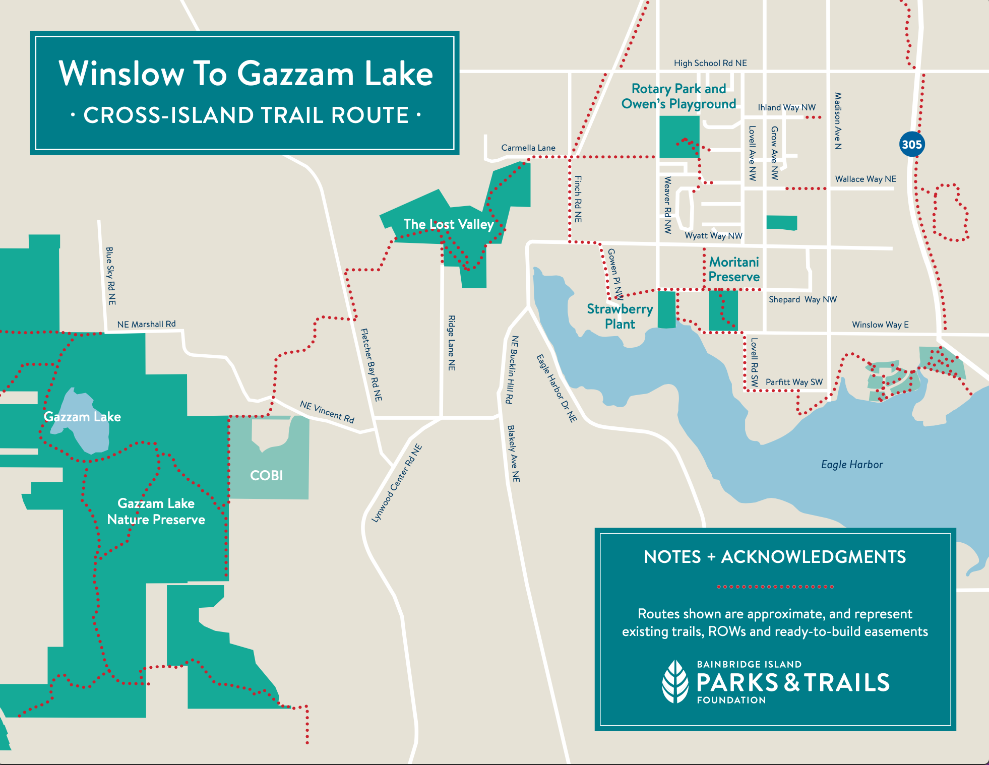
When completed, the mile-long trail will connect the Head of the Bay area with Fletcher Bay Road, through the Cooper Creek Watershed and woodland. It’s the approximate midpoint of the long-planned Cross-Island Trail route from Winslow to Gazzam Lake and Crystal Springs.
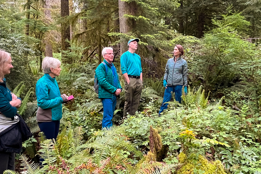
“There’s two decades of stories behind this, and we should celebrate as a community and as the City of Bainbridge Island,” said Andy Maron, Parks & Trails Foundation board member, who has worked on the project since inception. “Things get done – they take a while – but things get done when lots of organizations and people and governments work together.”
The project dates to the 1990s, when trails advocates posed the idea of a “shore to shore” trail across the island.
In 2004, the City purchased three properties and four trail easements at the Head of the Bay to protect open space and build trails connecting east and west. Today, the Lost Valley Trail is an informal “social trail” used by neighborhood walkers, but never improved to formal, recreational trail standards.
The Bainbridge Island Parks & Trails Foundation recently acquired the final trail easement (granting public access) needed to complete and improve the formal trail route.
“Easements are ‘the links between the links’ that make longer, continuous trails possible,” says Mary Meier, Parks & Trails Foundation executive director. “We’re grateful for generous property owners who step up to help us site new trails that will connect us all.”
Council members were enthusiastic in approving the Lost Valley Trail across the City land, approximately 45 acres east of the Head of the Bay. The trail will be improved to an approximate 3-foot wide woodland trail, with a new boardwalk to preserve the wetland south of Cooper Creek. The creek itself will be crossed on an existing culvert.
“It was one of those times on the island when you go somewhere and you don’t even know it’s there,” said Brenda Fantroy-Jones, after hiking the Lost Valley Trail route for the first time recently. “I discovered a piece of the island that I hadn’t been to before, and it was like being in the Olympics. It was so quiet, the stream was running … It was one of the best hikes I’ve ever been on.”
The Parks & Trails Foundation will highlight the Lost Valley Trail project at its National Trails Day event, Saturday, June 3.
The Foundation will soon begin the permitting process for trail and boardwalk construction. A fundraising campaign for construction of Lost Valley and other new trails is planned.
“Lost Valley is going to be central to our campaign,” Meier said, “because it’s central to the island.”
JOIN US ON NATIONAL TRAILS DAY: Celebrate Bainbridge Island trails with a fun and healthy hike on National Trails Day, Saturday, June 3. Pick up the newly updated “Trails on Bainbridge Island” map at Grand Forest Hilltop and lower Fort Ward Park from 10 a.m. to noon, hosted by the Bainbridge Island Parks & Trails Foundation. The large-format color map includes Bainbridge Island’s 48 miles of public trails, as well as nearby dining, services and other amenities for park and trail users. The Foundation will also hand out trail mix.