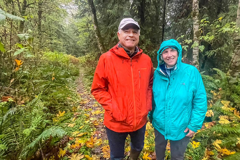

THE MIST TURNED INTO A DRIZZLE, THEN A STEADY RAIN, THEN A DOWNPOUR.
Not the most auspicious afternoon for even a Northwest hike in autumn. So the party tramped about 50 yards down the sodden trail, paused for a quick photo, and retreated to the shelter of a nearby barn to chat and recall the day, nearly two decades ago, they first bushwhacked across this same land.
“That was coming from the creek, up this way,” recalled Andy Maron, who served on the City Open Space Commission when “Lost Valley” first slipped into the local lexicon.
“I remember jumping over that stream,” Maron said, indicating nearby Cooper Creek. “You didn’t have to wade it, but jump over it.”
There was no trail in those days, and Maron, fellow Open Space Commissioner Connie Waddington and an ad hoc group of explorers crunched their way through thickets and clambered over fallen logs, en route to discovery. It was a grand little expedition, one of many as volunteers scouted out remote island properties for potential purchase as public open space and parks.
If you’re not familiar with the Lost Valley, well, consider the name. There are no formal or managed trails there, no sanctioned trailheads, no designation on any local map. Just a rough track beaten through the forest by neighbors and perhaps intrepid hikers seeking new and unfamiliar paths. It lies northwest of the Head of the Bay, closest to Wyatt Way, but that is only to say, somewhere off beyond that one house you may have passed by, or maybe that other driveway you’ve wondered about.
That’s about to change. Through a partnership of the City of Bainbridge Island, Bainbridge Metro Parks and the Bainbridge Island Parks Foundation, the Lost Valley will be lost no more.
It’s taken 18 years to get here, but … where is here, anyway?
REDISCOVERING THE LOST VALLEY
As Bainbridge this month marked 30 years as an all-island city, another anniversary quietly approaches: the 20th anniversary, next year, of the very first land acquisitions under the City’s old open space program.
Island voters in 2000 approved an $8 million open space bond, to protect as many large properties and create as many new parks as the money would stretch.
Over the next half-decade, the City Open Space Commission pored over maps to identify desirable parcels across the island, and worked with property owners to forge willing buyer-willing seller agreements.
It was a resounding success. Money from the Open Space bond and leveraged funds helped acquire the former Wyckoff land at Bill Point, which became 50-acre Pritchard Park; created Hidden Cove, Rockaway Beach, Hawley Cove, Williams-Olson, Nutes Pond and Meigs Farm parks; added more than 100 acres and a secluded beach to Gazzam Lake Preserve; and vastly expanded the public farmland district off Day Road.
In the middle of all that, in 2004, the City bought six acres of forestland near the Head of the Bay – roughly northwest of Ridge Lane and east of Fletcher Bay Road.
It was a complicated arrangement finally involving three property owners. But when added to land the City already owned next door, the modest buy completed a contiguous, 36-acre property that would be the linchpin of a true cross-island trail.
It’s a quintessential Northwest woodland, riven by a namesake valley with steep slopes climbing away to the northwest and bisected by the salmon-bearing Cooper Creek that feeds into Eagle Harbor. The second-growth forest is largely unspoiled by invasives, with fields of native ferns and trees adorned with a filigree of hanging moss. The trees are so dense at points that not even the sun can find a way in.
The City Council approved the purchase in April 2004, it got some play in the hometown press, and then … the Lost Valley faded back out of public consciousness. So it stayed for the next decade and a half, until plans for a cross-island trail finally began to take shape over the past few years.
Because the Lost Valley is essentially “land locked” by private parcels on all sides, the Parks Foundation acquired a series of trail easements – legal rights of access – from willing neighbors at points along the planned trail route. The easement purchases were supported by the Foundation’s dedicated Trails Fund for trail planning and acquisition.
To the west, new connecting trails are planned to Fletcher Bay Road and around the Vincent Road transfer station. To the east, new access points and connecting trails will be planned near Finch Road and Wyatt Way. When the full route is completed, it will be possible to hike from Winslow all the way to Gazzam Lake.
Hub of this network is the Lost Valley.
“The Lost Valley is an integral trail link between Winslow and Gazzam Lake Park,” said Mark Epstein, COBI project planning engineer. “It will open up a contiguous route across the central island to numerous destinations.”
Adds Maron: “It’s a long trail. From Winslow to Gazzam Lake, that’s probably going to be three and half to four miles, one way. That’s pretty cool. We have a lot of trails that tend to be shorter, but that’s a long trail.”
Bainbridge Metro Parks will build the trails under an agreement with the City, with construction anticipated in mid-2022.
At a virtual public meeting this evening (see below), the City will take input on the proposed route, trail standards, and possible parking at trailheads.
About the name: it has no real basis in local heritage or lore. But for the Open Space Commission, it was a fitting way to describe an area that most islanders were unfamiliar with, and create a little frisson in the bargain.
“We were going to call it ‘Hidden Valley,’” Waddington said, “but we realized that was a salad dressing. So we had to give it a different name.”
All these years later, the “Lost Valley” it remains – if now, finally, rediscovered.
—-
The City of Bainbridge Island hosts a virtual public meeting on the Lost Valley Trails project, 5 p.m. Monday, Nov. 15. This is an online meeting – read more about the project and find the Zoom link here. If you are unable to participate in the meeting but support the trail, take the short engagement survey.