Dolphin Drive to W. Port Madison Connector Trail
PROJECT UPDATE – AUGUST 2023
We’re excited to announce that Bloedel Reserve has generously agreed to partner on the Dolphin Drive to W. Port Madison Trail, and we have signed a construction agreement.
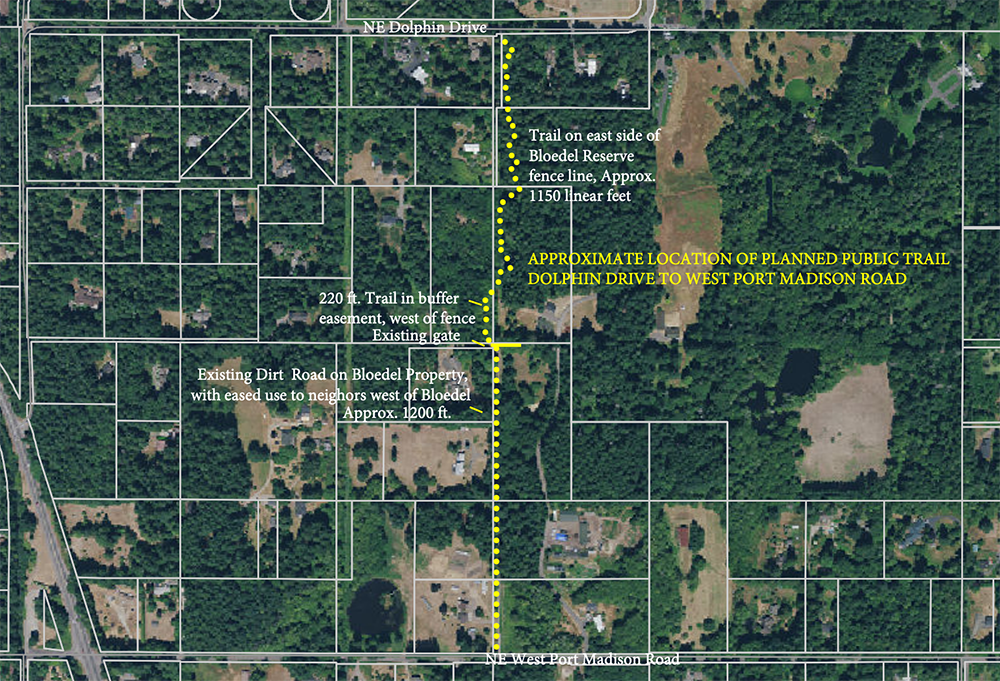
The trail will follow the Bloedel Reserve driveway, then meander through the woods north to Dolphin Drive. The route respects neighbors’ interests and minimizes impacts while serving neighborhood connectivity. Please do not try to walk this route today! We ask that you respect private property and wait until the trail is built and open.
TIMELINE
• 2023-24 – City permitting and project fundraising
• 2024 – Trail construction
TRAIL STANDARDS
A soft-surface trail –The south half of the trail is an existing gravel driveway. The trail north of that on a surveyed easement will be surfaced with 1/4-minus gravel.
Non-motorized use only – The trail will be for non-motorized use only: people on foot, sometimes on bicycle, and occasionally on horseback. No motorcycles, ATV’s or other vehicles would allowed except for maintenance purposes.
Maintenance – Following construction of the soft-surface trail, the entire trail easement will be transferred to the Bainbridge Island Metropolitan Park & Recreation District for permanent management and maintenance.
COMMUNITY BENEFIT
The northeast corner of Bainbridge Island is underserved by public trails for recreation and connection. The existing trails in West Port Madison Nature Preserve are not connected to other trails.
This will be a “neighborhood trail” – intended to serve local residents – and not a “destination trail” in or between parks and requiring parking.
Delivering a trail to the community, through a partnership of the Bainbridge Island Parks & Trails Foundation, Bainbridge Metro Parks, and Bloedel Reserve will further build out our islandwide trails network, which now runs 48 miles with a vision of safety and sustainably linking neighborhoods, parks, schools, culture and commerce.
WE INVITE YOUR COMMENT
The Bainbridge Island Parks & Trails Foundation wants to hear what you think. Please share your comments about this public trail plan by email to Barb Trafton, barb@biparksfoundation.org or through the button below.
Or reach out to a supporting neighbor to learn more about the proposed trail. Email Barb Trafton to be put in contact with neighborhood trail supporters.
Planned trail route
AERIAL VIEW
TRAIL ROUTE IMAGES
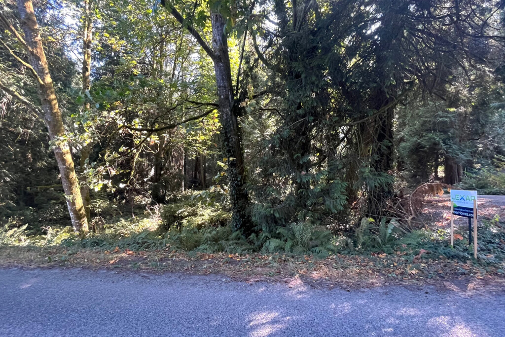
The north trailhead (proposed), looking south from Dolphin Drive. The trail would be constructed to the east of this lane, through the wooded area in the left of the frame.
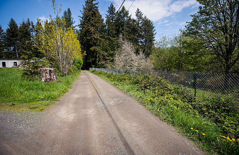
The south trail segment (proposed), an easement lane running north from West Port Madison Road along the southwest corner of the Bloedel Reserve property.
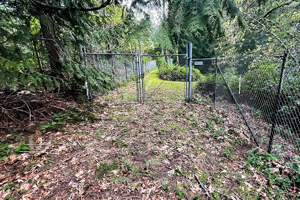
Access gate on west side of the Bloedel Reserve property. Here, the trail route would leave the access lane and shift to the west (left) into the woods, where a new footpath would be constructed.
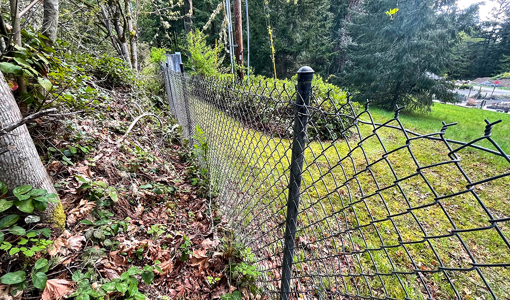
The trail would initially run along the west side of this fenceline, outside the west boundary of the Bloedel Reserve property and outside of sightlines from the Reserve’s visitor areas and programming. Therafter, the trail would be on the east side of the fence.
TYPICAL TRAIL CONSTRUCTION
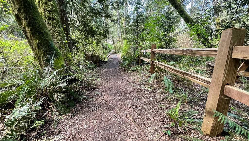
The Old Mill Trail that connects Old Mill Road and Blakely Avenue. This image shows typical trail construction, on an easement that is bounded by the IslandWood learning center on one side and private residential properties on the other. Signage on each side marks trail boundaries and adjacent parcels.


